Dhaulagiri stands as one of the most awe-inspiring mountains on earth. Rising to 8,167 metres (26,795 feet), it is the seventh highest peak in the world and Nepal’s crown jewel of extreme mountaineering. The name “Dhaulagiri” derives from Sanskrit — Dhawala meaning white or dazzling, and Giri meaning mountain. Together, they describe it perfectly: a luminous, ice-sculpted massif that dominates the western horizon of Nepal.
Unlike many Himalayan giants, Dhaulagiri rewards both seasoned climbers and determined trekkers. Its dramatic ridgelines, sweeping glaciers, and remote valleys make the region one of the most breathtaking trekking destinations in Nepal. Furthermore, the Dhaulagiri Circuit Trek takes adventurers through wild high-altitude terrain that few other trails in the Himalayas can match.
Whether your goal is standing at its summit or simply trekking through its shadow, Dhaulagiri deserves serious attention. This comprehensive guide covers everything — from Dhaulagiri height and location to trekking routes, climbing permits, costs, and expert travel advice.
| Feature | Details |
|---|---|
| Elevation | 8,167 m (26,795 ft) |
| World Rank | 7th Highest Mountain |
| Location | Myagdi and Mustang Districts, Gandaki Province, Nepal |
| Mountain Range | Dhaulagiri Himal (Himalayas) |
| First Ascent | May 13, 1960 — Ernst Forrer, Albin Schelbert, Kurt Diemberger, Peter Diener, Nawang Dorje, Nima Dorje |
| Expedition (First Attempt) | French Expedition, 1950 |
| Difficulty Level | Extremely Technical — Grade PD+ to TD |
| Climbing Status | Open (Government Permit Required) |
| Base Camp Elevation | ~4,750 m (15,584 ft) |
| Normal Route | Northeast Ridge |
| Nearest Major City | Pokhara (approx. 70 km east) |
| Trekking Season | March–May, September–November |
Dhaulagiri first captured European attention in the early 19th century. British surveyor Colonel William Lloyd identified it in 1820. At the time, scientists believed it might be the world’s highest peak — a distinction later given to Mount Everest after the Great Trigonometric Survey of India refined global altitude measurements.
The mountain’s official height was confirmed during systematic Himalayan surveys in the late 19th and early 20th centuries. Dhaulagiri then became a target for elite mountaineering expeditions. Notably, the first serious summit attempt came during the 1950 French Expedition led by Maurice Herzog, which ultimately diverted to Annapurna I instead — another eight-thousander nearby.
Between 1954 and 1960, nine expeditions attempted Dhaulagiri without success. All were defeated by its sheer technical complexity. Finally, on May 13, 1960, a Swiss-Austrian team achieved the first ascent. Albin Schelbert, Ernst Forrer, Kurt Diemberger, Peter Diener, along with Sherpa climbers Nawang Dorje and Nima Dorje, summited via the Northeast Ridge — still the most popular climbing route today.
Critically, this first ascent involved the use of a Pilatus Porter aircraft to transport supplies to a high camp — a landmark event in Himalayan logistics.
Dhaulagiri holds deep spiritual importance for local communities. The Magar and Thakali peoples of the Dhaulagiri region regard the mountain as a sacred entity. Local lamas perform puja ceremonies before each expedition season, asking for blessings and safe passage. The mountain is embedded in oral traditions and songs of the Kali Gandaki valley communities.
Dhaulagiri contributes significantly to Nepal’s adventure tourism economy. The Dhaulagiri Circuit Trek, one of Nepal’s most challenging and rewarding routes, attracts experienced trekkers from around the world. Consequently, the mountain has helped put Myagdi District on the global trekking map — boosting local employment, infrastructure, and conservation awareness.
Dhaulagiri is located in Myagdi District (southern flank) and Mustang District (northern flank), within Gandaki Province of central-western Nepal. Its precise coordinates are approximately 28.6983° N, 83.4928° E. The peak lies roughly 34 km northwest of Pokhara’s Phewa Lake by direct line and forms a striking barrier between the deep Kali Gandaki Gorge to the east and the Dolpo wilderness to the northwest.
Notably, the Kali Gandaki Gorge — which separates Dhaulagiri from the Annapurna massif — is recognised as one of the deepest river gorges in the world. The gorge descends over 5,500 metres from Dhaulagiri’s summit to the river below.
The Dhaulagiri Himal is a sub-range of the Greater Himalayas. It contains seven major peaks above 7,000 metres:
The mountain’s flanks are draped with several major glaciers, including the Chhonbardan Glacier (also called the Hidden Valley glacier), the Mayangdi Glacier, and the Kaphe Glacier. These glaciers feed rivers that eventually flow into the Kali Gandaki and Myagdi Khola river systems.
The terrain around Dhaulagiri is extreme. Steep ice walls, hanging glaciers, rockfall zones, and unpredictable weather systems make it technically demanding. Hidden Valley — a remote, flat glacial basin at approximately 5,100 metres — is one of the most photogenic landscapes in the Dhaulagiri circuit.
The Dhaulagiri region borders the Annapurna Conservation Area (ACAP) to the east, one of Nepal’s largest and most biodiverse protected zones. The western edge approaches the Shey Phoksundo National Park, home to snow leopards and red pandas.
There are two primary ways to experience Dhaulagiri’s wilderness on foot:
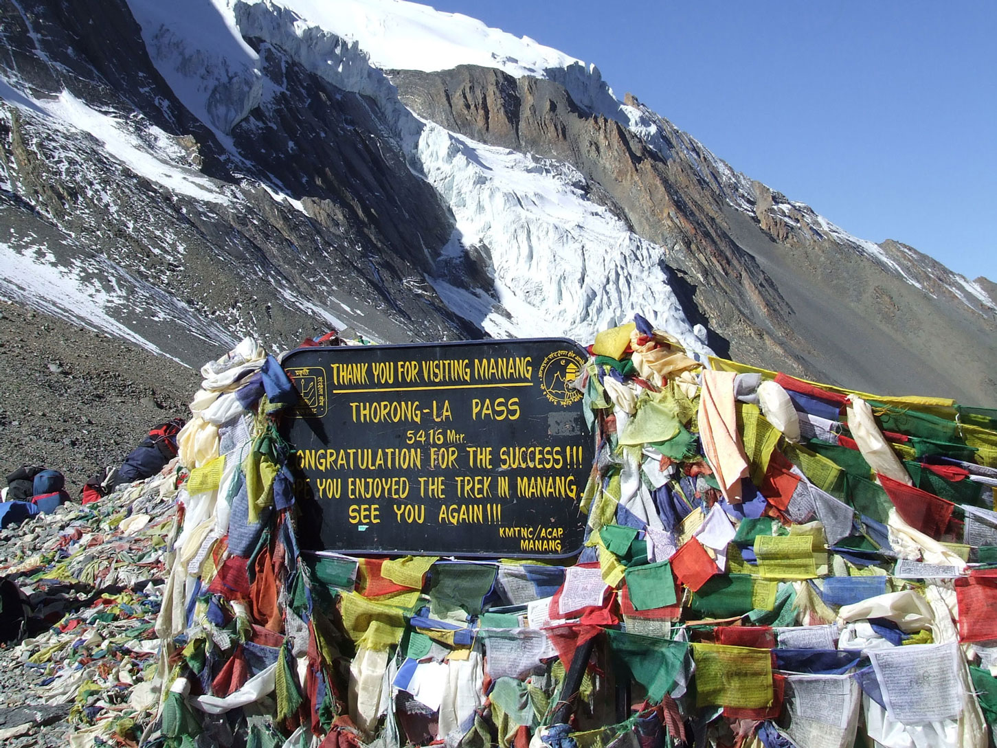
1. Dhaulagiri Circuit Trek This is the most famous and comprehensive route. It circumnavigates the entire Dhaulagiri massif, crossing two high passes — French Pass (5,360 m) and Dhampus Pass (5,182 m). The route passes through Hidden Valley, alpine meadows, remote Magar and Thakali villages, and offers unparalleled views of Dhaulagiri, Tukuche Peak, and surrounding giants.
2. Dhaulagiri Base Camp Trek This shorter route leads directly to Dhaulagiri Base Camp at approximately 4,750 metres. It follows the Myagdi Khola valley upward through forests, moraines, and glacial terrain. This option suits trekkers who want to experience the mountain closely without completing the full circuit.
The Dhaulagiri Circuit Trek is rated strenuous to extreme. It demands prior high-altitude trekking experience, excellent physical fitness, and mental resilience. French Pass and Dhampus Pass present serious challenges — particularly in unsettled weather. Trekkers should have prior experience above 4,000 metres before attempting this circuit.
| Route | Technical Grade | Notes |
|---|---|---|
| Northeast Ridge | PD+ | Standard route, most frequently used |
| Southeast Ridge | TD | Highly technical, rarely attempted |
| South Pillar | TD+ | Extremely difficult alpine route |
| East Face | ED | First climbed in 1981, rarely repeated |
| Trek Type | Approximate Distance | Duration |
|---|---|---|
| Dhaulagiri Circuit Trek | ~195 km | 18–24 days |
| Dhaulagiri Base Camp Trek | ~110–120 km | 12–15 days |
| Dhaulagiri Climbing Expedition | N/A | 45–60 days |
| Day | Route | Altitude |
|---|---|---|
| 1 | Pokhara to Beni by road | 820 m |
| 2 | Beni to Darbang | 1,150 m |
| 3 | Darbang to Muri | 1,850 m |
| 4 | Muri to Boghara | 2,350 m |
| 5 | Boghara to Dobang | 2,520 m |
| 6 | Dobang to Italian Base Camp | 3,660 m |
| 7 | Italian Base Camp to Dhaulagiri Base Camp | 4,750 m |
| 8 | Acclimatisation Day at Base Camp | 4,750 m |
| 9 | Base Camp to Hidden Valley | 5,100 m |
| 10 | Hidden Valley — Rest/Acclimatisation | 5,100 m |
| 11 | Hidden Valley to French Pass & Yak Kharka | 5,360 m / 4,050 m |
| 12 | Yak Kharka to Marpha via Dhampus Pass | 5,182 m / 2,670 m |
| 13 | Marpha to Jomsom | 2,720 m |
| 14 | Jomsom (optional rest/fly to Pokhara) | — |
| 15–21 | Return or extension via Mustang or Annapurna Circuit | — |
Note: Itinerary days may vary based on weather, group pace, and acclimatisation needs.
| Category | Estimated Cost (USD) |
|---|---|
| Budget Trekker (teahouse, basic) | $40–$70/day |
| Mid-Range Trekker (mixed accommodation) | $80–$130/day |
| Full-Service (agency-organised) | $1,800–$3,500 total |
| Guide Fee | $25–$35/day |
| Porter Fee | $18–$25/day |
| Item | Cost (USD) |
|---|---|
| Nepal Government Climbing Permit | $7,000 (per climber, Autumn); $7,000 (Spring) |
| Base Camp Manager Fee | ~$2,000 |
| Liaison Officer Fee | ~$3,000 |
| Garbage Deposit | $2,000 (refundable) |
| Expedition Agency Fee (full service) | $25,000–$55,000 per climber |
| Total Estimated Expedition Cost | $35,000–$70,000+ |
| Permit | Issuing Authority | Approximate Cost |
|---|---|---|
| TIMS Card | Nepal Tourism Board | $20 (tea house) / $10 (camping) |
| Annapurna Conservation Area Permit (ACAP) | NTNC | ~$30 (NPR 3,000) |
| Restricted Area Permit (if via Upper Mustang) | Immigration Office | $500+ (10 days) |
| Climbing Permit | Ministry of Tourism | $7,000 per climber |
The journey to Dhaulagiri’s trailhead begins at Nepal’s capital, Kathmandu. Travellers have two practical options for reaching Pokhara, the gateway city.
By Air: Buddha Air, Yeti Airlines, and Shree Airlines operate multiple daily flights between Kathmandu’s Tribhuvan International Airport (TIA) and Pokhara Airport (PKR). Flight duration is approximately 25–30 minutes. Ticket prices range from USD $75 to $120 one-way depending on the season. This is the fastest and most comfortable option. Importantly, early booking is essential during peak trekking seasons (March–May and September–November), when seats fill quickly.
By Road: Tourist buses depart from Kathmandu’s Thamel district daily, taking approximately 6–8 hours to reach Pokhara. Tickets cost around USD $8–$15. Private jeep or car transfers are also available, taking 5–6 hours. The Prithvi Highway route is well-maintained and offers scenic views of river valleys and hillside villages. Budget travellers commonly use this option as it is economical and accessible.
Once in Pokhara, travellers proceed to Beni — the principal gateway for the Dhaulagiri trek. Local buses and jeeps depart from Pokhara’s Baglung Bus Park regularly throughout the morning. The journey to Beni takes approximately 2–3 hours on a paved road that follows the Kali Gandaki River. The one-way fare is roughly USD $3–$6. Shared jeep services also run from Pokhara, offering a faster alternative at a slightly higher cost. Beni town has basic accommodation, restaurants, and permit check-posts where trekkers must register their TIMS card and ACAP permit.
For trekkers starting or ending the Dhaulagiri Circuit from the north, Jomsom is the key hub. Tara Air and Summit Air operate scheduled flights between Pokhara and Jomsom (2,720 m), taking approximately 20–25 minutes. The flight is one of the most scenic in Nepal, offering views of Dhaulagiri, Nilgiri, and the Kali Gandaki gorge from the aircraft window. Flight tickets cost approximately USD $100–$140 one-way. However, weather-related cancellations are frequent — particularly during spring and early autumn — so travellers must factor in buffer days. Alternatively, a road connects Pokhara to Mustang, though it is rough, particularly beyond Tatopani, and may require a 4WD vehicle.
The Dhaulagiri region is a biodiversity corridor of extraordinary richness. As trekkers ascend from Beni’s subtropical forests at around 820 metres, the vegetation transforms dramatically with every few hundred metres gained in altitude.
Lower elevations (820–2,500 m): Dense subtropical and temperate forests dominate here. Trekkers pass through lush stands of sal (Shorea robusta), bamboo groves, and mixed broadleaf forests rich in wild orchids, rhododendrons, and ferns. March and April bring vivid bursts of pink and red rhododendron bloom — a signature feature of the Himalayan spring.
Mid elevations (2,500–3,500 m): Blue pine, oak, and hemlock forests become predominant. Birdsong fills these forests; the Dhaulagiri foothills are home to colourful species including the Himalayan monal pheasant (Nepal’s national bird), blood pheasants, and various laughingthrush species.
High elevations (3,500 m and above): Alpine meadows, dwarf juniper scrub, and eventually bare rocky terrain and glaciers define the upper mountain. Snow leopards inhabit these high zones, although sightings are exceptionally rare. Himalayan tahr, blue sheep (bharal), and musk deer are more commonly spotted in the rocky terrain approaching French Pass and Dhampus Pass.
The communities along the Dhaulagiri trekking route reflect Nepal’s extraordinary ethnic and cultural diversity.
Magar people — one of Nepal’s indigenous groups — inhabit the lower valleys near Beni, Darbang, and Muri. Known for their agricultural traditions, the Magars have historically also been prominent soldiers in Gurkha regiments. Trekkers passing through Magar villages encounter traditional stone houses, terraced fields of millet and barley, and warm hospitality.
Thakali people of the Kali Gandaki valley (particularly around Marpha and Jomsom) are renowned traders and inn-keepers. Historically, Thakalis controlled the salt-trade routes between Tibet and the Terai plains. Today, their cultural heritage is visible in distinctive Thakali architecture — whitewashed stone houses with flat roofs and carved wooden windows. Marpha village, in particular, is famous for its apple orchards, apple brandy (local raksi), and the beautifully maintained monastery of Thakali Buddhism.
Gurung communities are found around Baglung and western Annapurna foothills. They maintain distinct traditions including shamanic practices (jhankri), folk music, and colourful festivals.
Trekkers on the Dhaulagiri route can engage authentically with Himalayan culture in several ways. Attending a puja ceremony at a village monastery — particularly during the spring trekking season — offers a rare and moving experience. Sampling local cuisine is equally rewarding: dal bhat (lentil soup with rice), thukpa (Tibetan noodle soup), momo (steamed dumplings), and buckwheat pancakes are trail staples with genuine regional character.
The hidden gem of Hidden Valley near Dhaulagiri Base Camp carries a quiet, sacred atmosphere. Its flat glacial terrain at 5,100 metres, hemmed in by white peaks, feels otherworldly. Many trekkers describe it as one of the most profoundly remote landscapes they have ever experienced.
Altitude sickness — medically termed Acute Mountain Sickness (AMS) — is the most significant health risk on the Dhaulagiri trek and climb. The route gains altitude rapidly in places, which makes careful acclimatisation essential.
Key prevention principles:
| Category | Items |
|---|---|
| Clothing | Down jacket (–20°C rating), waterproof shell jacket, thermal base layers (2–3 sets), trekking pants, fleece mid-layer, gaiters, sun hat, wool beanie, balaclava, liner gloves + insulated mitts |
| Footwear | Double-layer mountaineering boots (for summit), stiff trekking boots, camp sandals, wool/synthetic socks (5+ pairs) |
| Gear | 65–75L backpack, sleeping bag (–20°C), trekking poles, crampons, ice axe (for high sections), headlamp + spare batteries |
| Health & Safety | First aid kit, pulse oximeter, AMS medications (Diamox, Dexamethasone), water purification tablets/filter, sunscreen SPF 50+, lip balm |
| Documents | Passport, permits (TIMS, ACAP), travel insurance documents, emergency contacts, cash (NPR) |
| Electronics | GPS device or downloaded offline maps, solar charger or power bank, camera/phone |
Safety on the Dhaulagiri route demands more than physical fitness. Weather changes rapidly in the Himalayas — clear skies can turn to blizzards within hours at high altitude.
| Season | Months | Conditions | Recommendation |
|---|---|---|---|
| Spring | March–May | Clear skies, mild temperatures, rhododendrons in bloom, stable weather windows | ⭐⭐⭐⭐⭐ Best |
| Autumn | September–November | Post-monsoon clarity, excellent visibility, stable trail conditions | ⭐⭐⭐⭐⭐ Best |
| Winter | December–February | Extreme cold (–20°C to –40°C at altitude), heavy snowfall, passes often blocked | ⭐ Not Recommended |
| Monsoon | June–August | Heavy rainfall, trail erosion, leeches, poor visibility, landslide risk | ⭐⭐ Avoid |
Spring is widely regarded as the best season for both trekking and climbing on Dhaulagiri. Temperatures are rising after winter, and weather windows — periods of clear, stable weather suitable for summit attempts — are most reliable in April and May. Daytime temperatures at Base Camp range from –5°C to +5°C, while the lower valleys are warm and vibrant with wildflower blooms.
The primary advantage of spring is visibility. Views of Dhaulagiri, Annapurna, Nilgiri, and the Kali Gandaki valley are extraordinary on clear days. However, spring is also the busiest season, meaning teahouses fill up quickly and prices are higher. Booking accommodation and guides well in advance is essential.
Autumn is an outstanding alternative to spring. The monsoon ends in late September, leaving clean air, freshly washed trails, and crystal-clear mountain views. Temperatures are generally more moderate than spring at high altitude. October is particularly popular, with stable skies and manageable snowpack on the passes.
One advantage of autumn over spring is reduced crowding. Fewer climbing expeditions attempt Dhaulagiri in autumn compared to spring, making the high camps and routes somewhat less congested. Trekking trail conditions are generally excellent throughout October and November, though early snowfall can begin in November at the high passes.
Winter in the Dhaulagiri region is brutal. Temperatures plunge to –30°C or lower at altitude, and heavy snowfall frequently blocks French Pass and Dhampus Pass entirely. The lower valleys remain accessible, but the full Dhaulagiri Circuit is realistically only possible for extremely well-equipped and experienced mountaineers during this period. Most teahouses above Boghara close for winter. The season is therefore not recommended for standard trekking.
The monsoon season brings relentless rainfall to the Dhaulagiri foothills. Trails become muddy and slippery, leeches are abundant below 3,000 metres, and landslides are a genuine hazard. Cloud cover obscures mountain views for most of the season. Additionally, river crossings can become dangerous following heavy rainfall. Most experienced guides strongly discourage trekking the Dhaulagiri circuit during the monsoon. However, the upper sections of the route — particularly around Hidden Valley — sit in a rain shadow and can be drier than lower elevations.

")