Cho Oyu is the sixth highest mountain on Earth, towering at 8,188 metres (26,864 feet). It sits on the Nepal–Tibet border in the heart of the Mahalangur Himalayan Range. For climbers and trekkers alike, Cho Oyu is a legendary destination.
The name Cho Oyu comes from the Tibetan language. It translates beautifully as “Turquoise Goddess.” This name reflects the deep spiritual reverence that local communities have held for this peak for centuries.
Cho Oyu stands approximately 32 kilometres west of Mount Everest. It is widely considered the most technically accessible eight-thousander in the world. This makes it a popular stepping stone for climbers preparing for Everest.
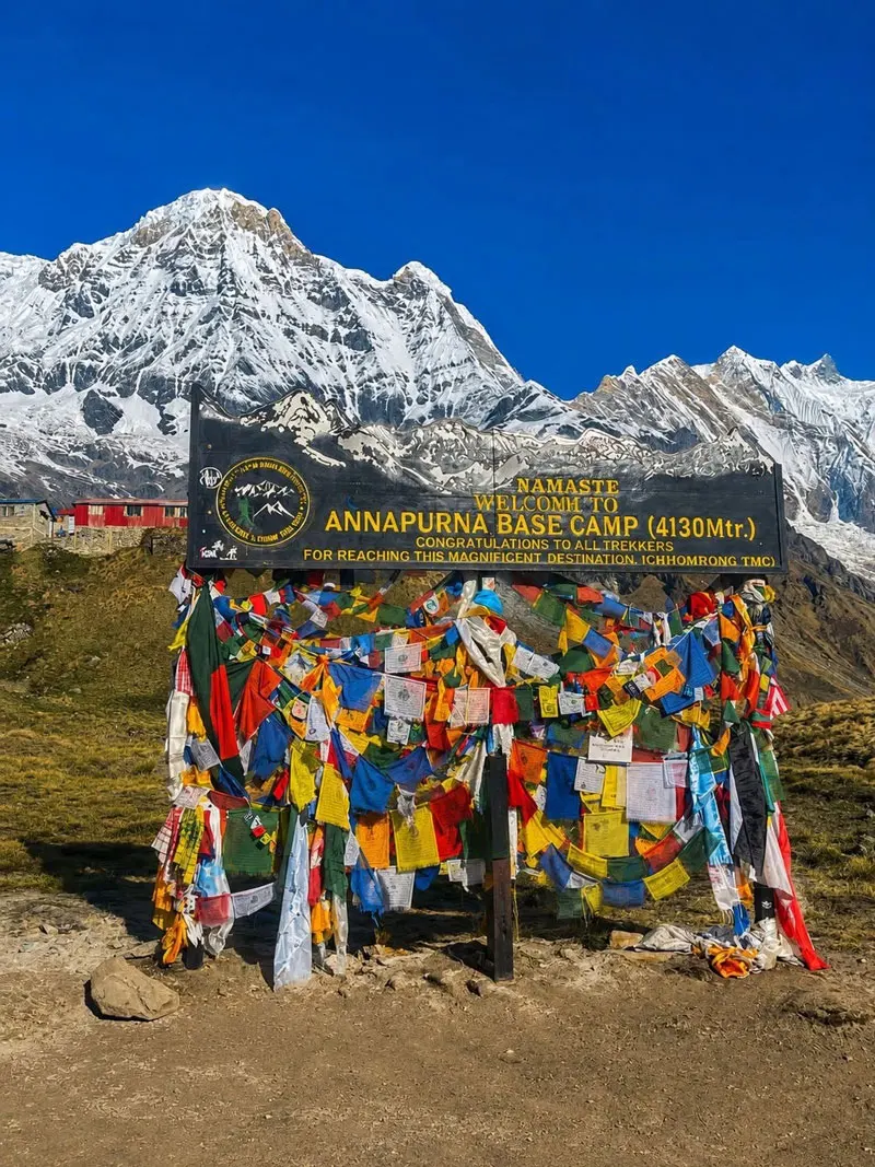
The mountain draws hundreds of climbers and trekkers every season. It falls within Sagarmatha National Park, a UNESCO World Heritage Site. The surrounding Khumbu region is one of the most iconic trekking destinations in all of Nepal.
Whether you dream of summiting an eight-thousander or exploring the breathtaking Gokyo Valley, Cho Oyu offers a world-class Himalayan adventure.
|
DETAIL |
INFORMATION |
|
Elevation |
8,188 m (26,864 ft) — 6th highest mountain in the world |
|
Location |
Solukhumbu District, Bagmati Province, Khumbu Region, Nepal |
|
Mountain Range |
Mahalangur Himalayan Range |
|
Coordinates |
28°6′ N, 86°39′ E |
|
Border |
Nepal–Tibet (China) International Border |
|
First Ascent |
19 October 1954 — Herbert Tichy, Josef Jöchler & Pasang Dawa Lama |
|
Difficulty Level |
Moderate — least technical eight-thousander |
|
Climbing Status |
Open (permit required from Nepal Government) |
|
Nearest Landmark |
Gokyo Lakes, Ngozumpa Glacier, Nangpa La Pass |
|
Parent Range |
Himalayas (Mahalangur sub-range) |
|
Best Seasons |
Spring (Apr–May) and Autumn (Sep–Oct) |
|
UNESCO Status |
Within Sagarmatha National Park — UNESCO World Heritage Site |
Cho Oyu was first mapped and surveyed during early British expeditions to the Himalayas. The mountain’s name originates from Tibetan. It means “Turquoise Goddess,” reflecting the spiritual value placed on high peaks by Tibetan Buddhist communities.
The mountain gained international attention in 1952 when Eric Shipton’s British reconnaissance team explored the region. The political border with Tibet added logistical complexity to early access. This delayed a formal summit attempt for several years.
The first ascent of Cho Oyu was achieved on 19 October 1954. Austrian mountaineer Herbert Tichy led the successful team. He was joined by fellow Austrian Josef Jöchler and the skilled Sherpa climber Pasang Dawa Lama.
The team ascended via the northwest ridge from the Tibetan side. Remarkably, they completed the climb without supplemental oxygen. This made Cho Oyu the first eight-thousander to be summited in this manner, setting a historic benchmark in mountaineering.
For the Sherpa people of the Khumbu region, Cho Oyu is a sacred deity. Local communities perform
puja ceremonies before every climbing expedition begins. These rituals seek divine blessings from the mountain spirit for a safe and successful journey.
The mountain sits near ancient trade routes connecting Nepal and Tibet. It has been a cultural landmark for centuries. Its presence shapes the identity and traditions of surrounding Sherpa villages.
Cho Oyu is a major driver of Nepal’s high-altitude tourism industry. Each expedition season brings hundreds of foreign climbers, guides, and support staff. The resulting income directly supports thousands of Nepali families in remote mountain communities.
Cho Oyu is located precisely at 28°6′ N, 86°39′ E on the Nepal–Tibet international border. It lies within Nepal’s Solukhumbu District, Bagmati Province. The mountain is part of the renowned Mahalangur Himalayan sub-range.
The terrain around Cho Oyu is dramatic and varied. High-altitude alpine meadows, glacial moraines, and jagged ice seracs define the landscape above 5,000 metres. The Ngozumpa Glacier stretches for kilometres below the mountain’s flanks.
The five sacred Gokyo Lakes shimmer at approximately 4,700–5,000 metres elevation. These turquoise glacial lakes are revered in both Hindu and Buddhist traditions. The nearby viewpoint of Gokyo Ri (5,357 m) offers one of the finest panoramic views of Cho Oyu and Everest.
Below 4,000 metres, the trail passes through dense rhododendron and birch forests. The Dudh Koshi River valley defines the lower approach corridor. The contrast between lush lower forests and stark high-altitude glacial landscapes is a signature feature of trekking in this region.
Cho Oyu falls within Sagarmatha National Park, established in 1976 and listed as a UNESCO World Heritage Site in 1979. The park protects extraordinary biodiversity. It is home to snow leopards, Himalayan tahr, red pandas, and hundreds of bird species.
Three main approaches lead trekkers toward Cho Oyu Base Camp. Each offers its own unique character and highlights.
The standard Cho Oyu climbing route follows the northwest ridge from the Tibetan side. Climbers establish three high-altitude camps above base camp. The route involves glacier travel, fixed ropes on steep ice, and high-altitude acclimatisation rotations.
The most technically demanding section is a steep ice face just below the summit plateau. Despite this, the route is significantly more straightforward than other eight-thousanders. Most guided expeditions maintain a strong summit success rate under good weather conditions.
|
Day |
Destination / Activity |
Altitude |
|
1 |
Arrive Kathmandu — permits, briefing |
1,400 m |
|
2 |
Fly Kathmandu → Lukla; trek to Phakding |
2,610 m |
|
3 |
Phakding → Namche Bazaar |
3,440 m |
|
4 |
Acclimatisation Day — Namche Bazaar |
3,440 m |
|
5 |
Namche Bazaar → Dole (Gokyo Valley entry) |
4,040 m |
|
6 |
Dole → Machhermo |
4,470 m |
|
7 |
Machhermo → Gokyo (Gokyo Lakes) |
4,790 m |
|
8 |
Acclimatisation: Hike Gokyo Ri viewpoint |
5,357 m |
|
9 |
Gokyo → Cho Oyu Base Camp |
5,700 m |
|
10–12 |
Rest / acclimatisation at Base Camp |
5,700 m |
|
13 |
Base Camp → Gokyo (return) |
4,790 m |
|
14 |
Gokyo → Namche Bazaar |
3,440 m |
|
15 |
Namche Bazaar → Lukla |
2,860 m |
|
16 |
Fly Lukla → Kathmandu |
1,400 m |
|
17 |
Depart Kathmandu |
— |
|
PERMIT |
FEE / DETAILS |
|
TIMS Card |
USD 20 per trekker (Trekkers’ Information Management System) |
|
Sagarmatha National Park Entry |
NPR 3,000 (approx. USD 22) per person |
|
Khumbu Pasang Lhamu Fee |
NPR 2,000 per trekker (local municipality charge) |
|
Nepal Mountaineering Permit |
USD 2,200 per climber (Nepal route) |
|
Tibet Climbing Permit |
USD 6,500–8,000 (required for NW ridge approach) |
The most popular and convenient way to begin the Cho Oyu trek is to fly from Kathmandu to Lukla. Tara Air and Summit Air operate daily scheduled flights from Tribhuvan International Airport to Tenzing-Hillary Airport in Lukla. The flight takes approximately 35 minutes and offers breathtaking aerial views of the Himalayan foothills and mountain ridges.
Flights to Lukla are weather-dependent and subject to frequent delays or cancellations, particularly during early spring. Travellers should always build two to three extra buffer days into their itinerary to accommodate weather disruptions. Booking domestic flights early is strongly advised, especially during the busy April–May and October seasons, as seats fill weeks in advance.
An increasingly popular alternative is flying from Kathmandu to Ramechhap Manthali Airport. During the peak trekking season, many Kathmandu–Lukla flights are diverted here to reduce congestion at Tribhuvan. Ramechhap is a four to five hour early-morning drive from Kathmandu, so planning an overnight stay nearby before the flight is recommended. The Lukla flight from Ramechhap takes only about 20 minutes, making the early start worthwhile.
Travellers preferring an overland approach can take a bus or jeep from Kathmandu to Salleri or Phaplu in Solukhumbu District. The drive takes approximately eight to ten hours along mountain roads. From either town, trekkers follow the classic lower-Khumbu trail to Lukla, adding seven to ten extra walking days to the overall itinerary.
This road journey is an excellent option for budget travellers and those who want a deeper immersion in rural Nepal before entering the high mountains. The route passes through traditional Rai and Sherpa villages, terraced farmland, and dense subtropical forests. Local jeep services and shared vehicles depart daily from Kathmandu’s Gongabu Bus Park; booking in advance during peak season is advised.
Road infrastructure in the Solukhumbu region is still developing, with ongoing construction extending access closer to the Khumbu Valley year by year. Conditions on mountain roads can deteriorate during the monsoon season due to landslides and washouts. Travellers who choose this route should carry extra days of flexibility in their schedule and be prepared for rough road conditions on the final stretches before reaching the trailhead.
Once at Lukla, all Cho Oyu treks follow the well-marked trail north through Phakding to Namche Bazaar. Namche is the primary acclimatisation hub and gateway town for the entire Khumbu region. The route then branches northwest along the Gokyo Valley, passing through Dole, Machhermo, and Gokyo before reaching Cho Oyu Base Camp at 5,700 metres.
The lower trail sections below 4,000 metres pass through lush forests of rhododendron, birch, fir, and juniper. In spring, these forests explode in vivid shades of red, pink, and white as rhododendrons bloom. Higher up, hardy alpine plants including dwarf shrubs, lichen, and medicinal herbs like neem and cordyceps cling to rocky terrain.
The wildlife of Sagarmatha National Park is extraordinary for a high-altitude environment. Snow leopards, Himalayan tahr, musk deer, and elusive red pandas inhabit the park’s diverse zones. The Himalayan monal pheasant — Nepal’s national bird — is frequently spotted along the trail. Alpine choughs, lammergeiers (bearded vultures), and Himalayan griffons soar above the glaciers.
The Ngozumpa Glacier, Nepal’s longest at approximately 36 kilometres, is a defining natural feature of the Cho Oyu approach. The glacier is actively retreating due to climate change, making it a striking visual reminder of global environmental challenges. The five Gokyo Lakes, formed by glacial meltwater, are considered sacred in both Hindu and Buddhist traditions and are protected within the national park boundaries.
The Sherpa people are the dominant ethnic community throughout the Khumbu region. Sherpa culture is deeply rooted in Tibetan Buddhism and shaped by centuries of living at extreme altitudes. Their villages — including Namche Bazaar, Khumjung, and Thame — are adorned with colourful prayer flags, chortens (stupas), and mani stone walls carved with Buddhist mantras.
Tengboche Monastery, perched at 3,867 metres with a sweeping panorama of Everest and Ama Dablam, is one of the most visited and revered religious sites in the Himalayas. The annual Mani Rimdu festival at Tengboche draws both local pilgrims and international visitors. This spectacular Buddhist festival features masked dances, rituals, and prayers performed by monks from the monastery.
The Thame Valley, a key approach corridor to Cho Oyu, holds deep historical significance as the birthplace of Tenzing Norgay Sherpa, who co-summited Everest in 1953. Thame Monastery is one of the oldest in the Khumbu region and remains an active centre of Buddhist learning. Walking through Thame provides an authentic and unfiltered experience of Sherpa mountain life, offering a perspective far removed from the busier sections of the Everest Base Camp trail.
Cho Oyu’s trekking region lies within Sagarmatha National Park, inscribed on the UNESCO World Heritage List in 1979. The park covers 1,148 square kilometres and protects some of the most dramatic mountain scenery on Earth. Its exceptional natural and cultural values make it one of Nepal’s most treasured conservation areas.
Acute Mountain Sickness (AMS) is the primary health risk for all trekkers and climbers heading toward Cho Oyu. The most effective prevention strategy is ascending slowly and incorporating dedicated rest and acclimatisation days at key elevations. Most responsible itineraries include mandatory rest days at Namche Bazaar (3,440 m) and a gradual ascent through the Gokyo Valley to allow the body to adapt progressively.
The widely accepted mountaineering principle of “climb high, sleep low” is essential practice on this route. During acclimatisation days, trekkers should hike to a higher elevation and then return to sleep at the lower camp. Drinking three to four litres of water daily, avoiding alcohol and sedatives, and eating regular carbohydrate-rich meals all support the body’s acclimatisation process significantly.
Carrying a portable pulse oximeter allows trekkers to monitor blood oxygen saturation (SpO2) throughout the trek. If SpO2 drops below 85% and symptoms worsen, descending immediately is the correct and potentially life-saving response. The medication acetazolamide (Diamox) is frequently prescribed as a preventive aid; always consult a physician before departure. Travel insurance that covers emergency helicopter evacuation from remote Himalayan terrain is not optional — it is essential.
Always hire a licensed, experienced Nepal mountain guide through a registered and government-approved trekking agency. A qualified guide provides critical support in navigation, emergency response, and altitude health monitoring. Never trek alone above Namche Bazaar, particularly in poor weather when trails can become icy and disorienting.
Register your full trekking itinerary with your country’s embassy or consulate in Kathmandu before departure. Share your itinerary and daily check-in schedule with a trusted contact at home. Many reputable trekking agencies now provide GPS tracking devices or satellite communication equipment for remote high-altitude sections of the route.
Weather conditions in the Himalayas can change rapidly and without warning. Always carry extra food rations, emergency thermal layers, and a comprehensive first aid kit. Strictly follow the judgment of your Nepal mountain guide regarding weather windows and turn-around decisions. No summit or viewpoint is worth compromising personal safety — the mountain will always be there for a return visit.
Choosing the right season is one of the most important decisions for any Cho Oyu trekker or climber. Each season has its own character, advantages, and challenges.
Plan Your Cho Oyu Adventure Today
Nepal Tour Package offers fully customised Cho Oyu treks and guided expeditions.
Our expert Nepal mountain guides bring years of high-altitude experience and local knowledge.
www.nepaltourpackage.com